

Bill Baird
The Medina River Greenway is the second leg of the author's quest to circumnavigate the Alamo City by foot.
The first portion of my journey took me the length of Leon Creek, from The Rim trailhead to the Medina River Valley. Those 37 miles unfolded magically at first, revealing hidden cliffs and blooming native species.
The last leg, however, was a 15-mile slog along farm roads, under railroad tracks and through junkyards. Although the city has promised an interconnected trail system, called the Howard Peak Greenway, there’s a massive missing piece between Leon Creek and the Medina River portion.
That first hike complete, I set out on my next phase of the journey, a trek down the length of the Medina River Greenway. This one seemed more promising — a walk along one of the most historically significant parts of the city.
I began at first light from the Medina River trailhead at Palo Alto Road and headed east as the path undulated alongside the river. Sign after sign warned of snakes. “Stay on trail!” they screamed.
Me being me, I headed off-trail as soon as possible. Snakes didn’t snag me, but the river bottom’s brambles drew blood from my exposed legs and led me to retreat. Not the best time to forget my hiking pants.
I scrambled up an adjacent bluff on the river’s north side and spied an abandoned factory in slow decay, swallowed by the undergrowth. Prickly pear cacti clumped the hillside, their green skin speckled with the once-precious dye cochimil. I walked on, in awe of this ancient place. There is a palpable history that hangs on the Medina — almost like a fog, full of possibility and begging exploration.
Meeting place of cultures
I’m not just some crazed hiker who’s had a little too much fresh air. There’s a reason for this observation — the area has been constantly inhabited for thousands of years. Indeed, it was where the first Spanish explorers met San Antonio’s native tribes.
Early expeditions, led by Alonso de Leon, Fray Damian Mazanet and others first crossed the Medina in the 1690s, reporting the presence of at least six tribes with encampments by the river: Tilpayay (Payaya), the Cauya, the Semonam, the Saracuam, the Pulacuam, and the Anxau (Xauno). Collectively, these groups became known as the Coahuiltecans. The natives called the river Penapay, but Leon renamed it after Pedro de Medina, a 16th century astronomer.
The Coahuiltecan pathways and crossings over the Medina and San Antonio rivers became part of El Camino Real de Los Tejas, also called the King’s Highway or Old San Antonio Road, which originally ran from Mexico City to present-day Louisiana. The former route was designated a National Historical Trail by President George W. Bush in 2004. Yes, the Medina Greenway is nationally recognized. Props to Dubya for recognizing the place’s significance.
As I learned, it’s a special part of the city.
Bill Baird
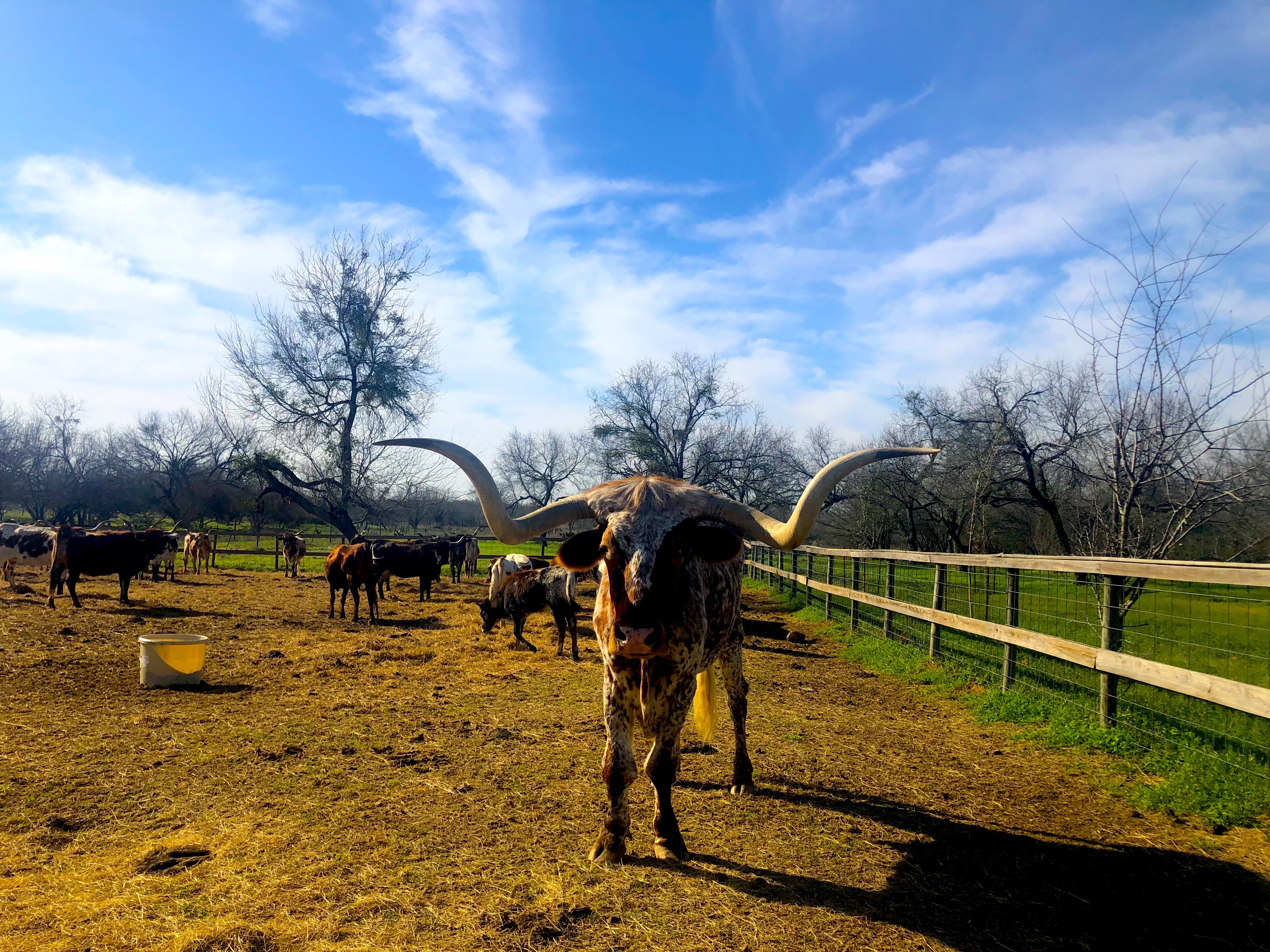
A herd of longhorns lives on the Land Heritage Institute property, which the Medina River Greenway passes through.
One of the river crossings of the Camino Real was near present-day Applewhite Road. Longtime residents will recognize the name. The area was nearly lost when the city of San Antonio used eminent domain to set aside the land for the controversial Applewhite reservoir. After multiple lawsuits and the discovery of a native campsite dating back at least 8,000 years, the area was saved from submersion.
What the city lost in water storage, though, it gained in wonderful open space. The Land Heritage Institute (LHI), whose 1,200 acres constitute what was to be the Applewhite reservoir, is an undiscovered jewel, containing the Watson-Presnall homestead — a national historic landmark — and the Beene archaeological site, which has yielded more than 40,000 ancient artifacts.
The Medina River Greenway trails passes right through the LHI property, but to access the 20 miles of trails on the property, hikers must secure special permission.
“We love visitors — school groups, outdoor classes. We are a land museum,” LHI head Peggy Oppelt said as she kindly met me for a walk through the property. “We had to fight very hard to save this place.”
Despite its weighty sounding name, LHI is actually a family operation. Oppelt and her husband are the current caretakers, and she’s a descendent of the Watson family, whose homestead carries the national historic designation. Her grandfather was born there.
A rare win
The land feels like a hidden jewel and a link to SA’s past. A herd of longhorns, owned by the Texas Cattlemen’s Longhorn Registry, snorted at me as I stared in disbelief at their enormous horns.
“They’re a walking exhibit for the museum,” Oppelt said.
But there were natural wonders beyond the walking, snorting exhibit. The elusive Golden Cheeked Warbler, an endangered bird and rare prize for area birders, was first spotted on the property in 1864.
Native plants also delight with their variety and abundance — dogwood, wild plum, Spanish dagger, yucca, yellow Indian grass and inland sea oats, to name a few. In the riparian zone by the Medina, we saw Pecan, hackberries, cedar elm and grapevines.
“The Texas Grapevine saved the French wine industry,” Oppelt noted. “When their vines were stricken with a fungus, Texan grapevines were grafted onto theirs. Yep. Texas saved France,” she added with a laugh.
The LHI should be celebrated as that rarest of Texas occasions — an environmental win. A beautiful open space that was spared development’s insatiable appetite.
Camping is available, too, though preferably for larger groups volunteering to maintain the property. All the trails were built with volunteer labor, mostly Americorps and Eagle Scouts. Highly recommended. And to any outdoor service group looking to make a difference in our city, look no further.
Stay on top of San Antonio news and views. Sign up for our Weekly Headlines Newsletter.
