There’s no better way to enjoy beautiful weather than by hitting the trails, so we rounded up some of the most gorgeous parks and greenways in San Antonio for hiking and biking. While SA is flush with outdoor amenities, other rewarding green spaces await those willing to venture outside of Loop 1604 and explore the surrounding countryside.
Fire up those muscles by exploring the Museum Reach.
Museum Reach is a great way to experience basically a variety pack of famous Alamo City sites. It’s an extension of the River Walk that touches the San Antonio Zoo, the Japanese Tea Gardens, Brackenridge Park, the Pearl, the Witte, the DoSeum and SAMA. It’s like part exercise and part exploring, but not so much exercise that you’ll be too tired to explore.
Photo via Instagram / ryanibarra24Credit: Courtesy of the City of San AntonioMedina River Greenway
sanantonio.gov
The Medina River Greenway is about a 3.5-mile trail connecting the Pleasanton Trailhead to Mattox Park, which is located along McAllister Freeway outside of Loop 410 on the South Side. Because it hugs the edge of Mitchell Lake, you can expect to see some cool sights. When the weather is nice, you’ll see seasonal birds, lakeside wildlife and healthy vegetation. This greenway has paved areas, so it’s perfect for someone who prefers paved rides to rough terrain rides. If you’re intrigued by this shot, head to the greenway near the Palo Alto trailhead.
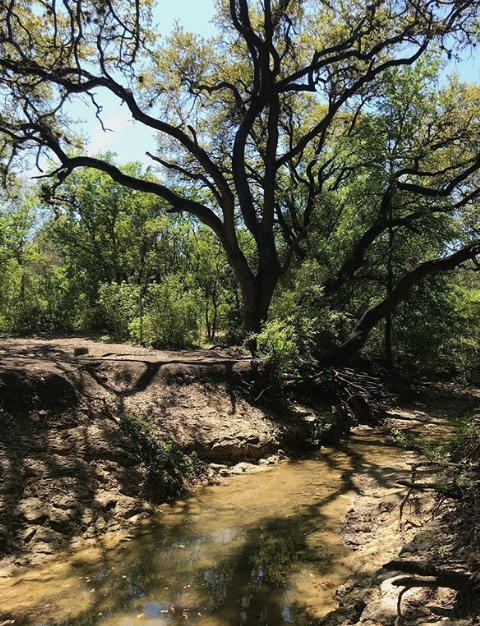
Photo via Instagram / texasbyairBrackenridge Park
3700 N St Mary’s St, (210) 207-7275, brackenridgepark.org
Brackenridge Park is located near Alamo Heights, the Witte Museum and the San Antonio Zoo. It’s also home to the Sunken Gardens Theater and the Japanese Tea Gardens, as well as some of the thiccest (hehe) trees you’ve ever seen. It’s a shady spot — in a good way. Brackenridge Park is named so from being donated in 1899 by a philanthropist named George Washington Brackenridge, who was an advocate of women’s suffrage and education for minorities. Hell yeah.
Photo via Instagram / peterbnyrenphotoEisenhower Park
19399 NW Military Hwy, (210) 207-7275, sanantonio.gov
Take advantage of the 6+ miles of trail at Eisenhower Park and get to exploring. Choose from both manmade and natural trails, though the natural Hillview trail will take you around the entire park.
Photo via Instagram / redbonecoonhoundlukePearsall Park
4838 Old Pearsall Road, (210) 207-7275, sanantonio.gov
Though one of the more popular parks on this list, Pearsall Park still does not get the credit it deserves compared to more-frequented green spaces in the city. In the southern sector of the city, this park is all about wide open spaces and getting active. There’s a playground, skate park, splash pads and even an outdoor gym — and a 18-hole golf course. Yep, you can get moving here.
Photo via Instagram / zlara_photographyFriedrich Wilderness Park
21395 Milsa Dr, (210) 207-3781, fosana.org
While 7 trails gives you plenty of options to exploring the park and getting your hike on, we’ve got to recommend the Main Loop Trail and the Water Trail. Rated a level four by the , these trails are perfect serious hikers who want to work their muscles and enjoy the beauty of the nature around.
Photo via Instagram / robert_em_eyeO.P. Schnabel Park
9606 Bandera Rd, (210) 207-7275, sanantonio.gov
Enjoy the natural vegetation at Schnabel from one of six trails and loops throughout the park. In side the park, you’ll be able to venture out to the woods to really feel like one with nature.
Photo via Instagram / christinabuneOlmos Basin Greenway
sanantonio.gov
The Olmos Basin Greenway Trail runs between Jones-Maltsberger Road and Devine Road and is about a mile or so long. Because of the mature trees in Olmos Basin Park, the greenway trails are almost entirely shaded, offering relief from the hot Texas sun on sweltering days. If you decide to go during the summer, or let’s be real, any other season in Texas, the shade doesn’t necessarily mean that it’ll be cool. Luckily, it runs along Olmos Creek.
Photo via Instagram / cmcpumaCathedral Rock Park
8002 Grissom Road, (210) 207-7275, sanantonio.gov
Looking for a spot that gives serious nature vibes, but you don’t have to go far to get them? You’ll appreciate Cathedral Rock. Here you’ll be able to enjoy trails — whether you choose to bike or walk them — as well as big grassy areas and picnic tables too if you’re looking to sit back for a bit. There’s also playgrounds so the kids can run around.
Photo via Instagram / nic_is_nicoleStone Oak Park
20395 Stone Oak Pkwy, (210) 207-7275, sanantonio.gov
More like a hike-and-bike park, Stone Oak Park has paved and unpaved trails totaling to about three miles. While it’s perfect for moving around and staying active, it also has pavilions, playgrounds and open areas to stay and play or rest for a bit. Located near Canyon Ridge Elementary School, Stone Oak Park is a great place to take your kids and yourself for a walk to unwind in the cooler weather.
Photo via Instagram / psychadelic_beeHuebner Creek Greenway
sanantonio.gov
Huebner Creek Greenway runs along Huebner Creek (duh!). It extends for about one and a half miles between two other trails, Crystal Hills Trailhead and Leon Creek Greenway. If you’re into a more private trek, Huebner Creek Greenway is probably the way to go since it’s much less known than the Leon Creek Greenway that it connects to, but you’ll probably still run into some people. Just make sure that you’re ready and geared up for some rough terrain.
Photo via Instagram / ramonhg81Leon Vista
8561 Rochelle Road, (210) 207-8480, sanantonio.gov
Just because alcohol is prohibited at Leon Vista Park (like most other parks in SA) doesn’t mean you can’t have a good time. This park is more of a hike-and-bike park than a sit-and-picnic park, which makes it perfect for the biker in you. The trails aren’t super well-known, so if you want to spend some time alone in nature, this is probably the park/trailhead for you to hit.
Photo via Instagram / coldpizzatxMcAllister Park
13102 Jones Maltsberger Road, (210) 207-7275, sanantonio.gov
McAllister Park has a lot to offer: pavilions, picnic tables, grills, playgrounds, ample parking and dog parks, but the reason it made it on this list is the trails. The park has around five miles of paved trails, perfect for biking. As far as unpaved trails go, you’ll find about 10 miles of them winding through the 976 acres of McAllister Park between Jones-Maltsberger and Wetmore roads. Because McAllister Park has so much to offer and so much parking, don’t expect to be alone too much.
Photo via Instagram / mcallisterparkCibolo Nature Center
140 City Park Rd, Boerne, (830) 249-4616, cibolo.org
There’s plenty to do at Cibolo Nature Center, and the trails are short enough that you’ll be able to explore the entire center in a day. Throughout the property you’ll be able to hike marshes and open meadows alike. Plus, you can learn more about the dinosaur tracks that were discovered in 1997.
Photo via Instagram / kate.alineSalado Creek Greenway
sanantonio.gov
The Salado Creek Greenway runs between Jack White Park and Southside Lions Park. At a distance of 7.2 miles, this trail is perfect for a biker who loves long … looooong rides through nature. As you pass, you’ll see several species of trees, like pecan trees, and at the points where it hugs the Salado Creek more tightly, you’ll get views of creatures that make water sources their homes. While Salado Creek Greenway isn’t the most popular site on this list for bikers, it’s still perfect to hit on a hot summer day where you can be shaded by the towering trees on either side of the path.
Photo via Instagram / _._snapLeon Creek South Greenway
sanantonio.gov
Leon Creek South Greenway, not to be confused with the Leon Creek Greenway, runs near Pearsall Park on the city’s South Side. It is located near Quintana Road, and is multi-use friendly, meaning that it is mostly paved and safe for joggers, walkers, bikers and maybe even roller bladers, so be aware that you might encounter a variety of other people using this trail. There are also seating areas for when you get tired or need a break, but that also means that there are some spectators if you do something wrong and fall off your bike. We’ve all been there.
Photo via Instagram / epicmtbsatxPhil Hardberger Park
13203 Blanco Road, (210) 492-7472, philhardbergerpark.org
For those who don’t know, or who have never realized it while they were visiting, Phil Hardberger Park is divided into two sections, East and West, by Wurzbach Road. For bikers (and pedestrians!), the East section has almost three miles of paved trails, and the West section has more than four miles of trails. The trails on the east side of the park connect to the Salado Creek Greenway, which is also on this list. Biker beware — the trails do not have amenities such as water fountains or trash cans, so the park recommends that you bring water and implores you not to litter.
Photo via Instagram / john.a.dickinson.6.8Guadalupe River State Park
3350 Park Rd 31, Spring Branch, (830) 438-2656, tpwd.texas.gov
You’ll even be able to ride your horse on certain sections of the 13 miles of trails. If you want a rougher terrain, try the lesser-traveled Bauer Unit.
Photo via Instagram / guadaluperiverstateparkGovernment Canyon State Natural Area
12861 Galm Rd, (210) 688-9055, tpwd.texas.gov
You won’t have to travel far to enjoy the wide open spaces at Government Canyon. The natural area offers more than 40 miles of trails, ranging from gentle rolling grasslands to rugged terrain. Choose your path wisely – the Joe Johnson Route lets you see dinosaur tracks, while the Far Reaches Trail gives you unbeatable views.
Photo via Instagram / adrigcg